Urban&Civic have announced that work will start later this month to improve the existing shared use path running alongside the A10 from Denny End Road to Ely Road, Milton. The work will also include improvements to the Car Dyke Road / Waterbeach Road junction and the installation of a Toucan crossing.
The measures form part of the planning framework for the Waterbeach Barracks development and have been approved by the Highways authority – Cambridgeshire County Council – and the planning authority – South Cambridgeshire District Council. They are being carried out by Urban&Civic – who are taking forward the development of Waterbeach Barracks on behalf of the Defence Infrastructure Organisation – under agreement with the County Council.
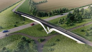
The work is part of a package of measures to encourage sustainable travel by both new residents in the development and the wider area, and it comes forward alongside an adjacent off-road cycle route along the Mere Way, which will connect the development to Cambridge Science Park, Cambridge Regional College and onward cycle links. This route will also see a bridge being installed over the A10 for use by cyclists, pedestrians and horse riders. The works also come in advance of the planned improvements along the A10 which are being led by the Cambridgeshire and Peterborough Combined Authority and have been worked up alongside the Waterbeach Greenway plans for an additional off road cycle connection between Cambridge and Waterbeach.
What the work entails
The works focus on widening the existing path, along the length of the A10 from the Barracks site, north of Denny End Road, down to Ely Road Milton. The route will then connect with existing routes through Milton village and to the Jane Coston Bridge to connect to the wider cycle network.
The path includes a 0.5m separation zone from the A10 roadway, and then the pathway which will be extended as wide as possible along the route, working within the constraints of the adopted public Highway boundary, such as drainage ditches, mature trees and neighbouring properties. The works will provide a red surfaced route to differentiate the pedestrian and cycle route from the road.
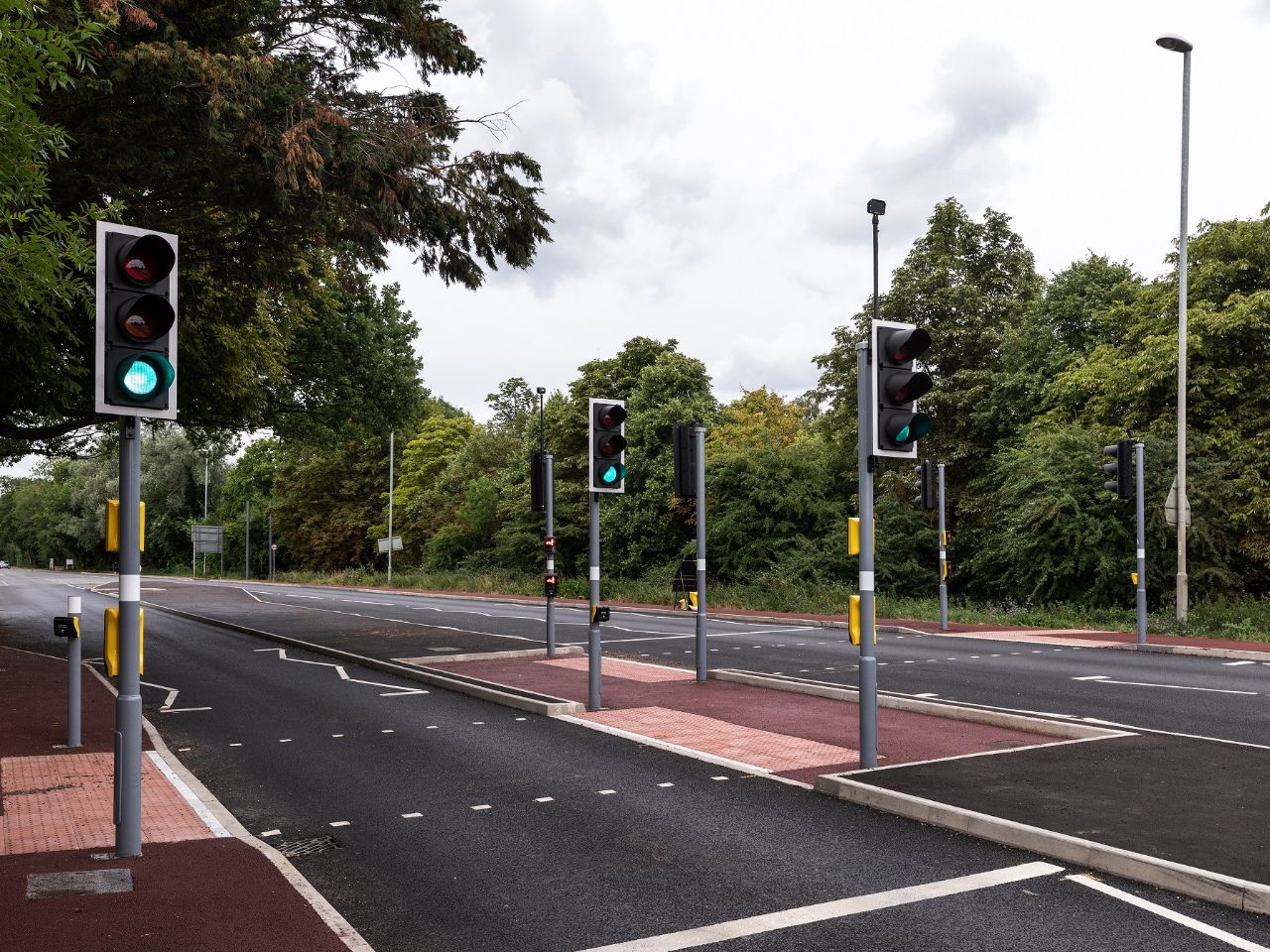
In key locations where possible, the measures will narrow the A10 carriageway (taking road carriageway currently not used/under used by cars and converting it to be part of the shared use path) and realigning the junction between the A10 and Car Dyke Road. A refuge island and crossing point will be installed at Car Dyke Road, and a Toucan Crossing will also be put in place across the A10 just north of Waterbeach Road to provide a safe crossing point.
When these works will take place
Works will start at the junction between the A10 and Car Dyke Road week commencing 24 January. This work will require the end of Car Dyke road to be closed from 31 January for approximately four weeks. During this time people will need to use the Denny End Road access to Waterbeach village.
The wider route along the A10 will take place in a rolling programme of 12 months, starting from Car Dyke Road and moving north to Denny End Road, then going back to Car Dyke junction, and moving south towards Ely Road Milton. The exact timings of these works will be given in further updates as the work progresses.
Work along the A10 will be carried out off peak to minimize the impact on traffic, and the road will be open at all times, with one lane closed in the area affected by the works. This will be managed by Traffic lights co-ordinated by the team carrying out the works. The lane restrictions will be removed during peak hours where possible.
Caroline Foster, Project Director for Urban&Civic added:
“We have been in discussion with many parties to ensure these improvements – while heavily constrained by the width of the public highway available for us to use – do make the existing route wider and safer than it is currently. We will also shortly be starting delivery of the off road Mere Way route, so that all of these cycle options are available for new residents from day one, but also benefit the wider local area and connections.
“We have been working hard with local partners to ensure that we minimise disruption while the works are going on, and will continue to monitor and respond to any issues that arise. We will also be updating local residents and interested parties with additional information as the work proceeds.”
Questions and Answers
1. What will the cycle lane be like?
98% of the route will provide at least 2.5m, mostly 3m and in places 4m width of shared cycle and pedestrian space.
The whole of the 2.3km length of the works includes a 0.5 separation area alongside it. We would have loved for this to be 1m, in line with the latest cycle guidance (LTN 120), but this is not possible along the full length of it, and would reduce the width of the path further where it is already constrained. And even where it is wider it would not be appropriate to vary the width of the buffer along the length, so in discussion with the Highways Authority we have agreed this is appropriate. This is in line with the LTN guidance for a 40mph route, so while not ideal, it is a significant improvement to what is there already.
The route will have a red surface treatment to further differentiate it from the road, in line with County Council guidance on shared cycle/pedestrian routes.
2. Are the plans less than government guidance?
The 0.5 m separation zone, while not ideal is within the guidance of LTN 120 for a 40 mph road. On the broader width, we have worked incredibly hard to squeeze every inch of space for this route. The guidance looks for 3m width. The vast majority of the route is 2.5-3m wide. The only area that is not is a 45m length pinch point, and of that 14m is the narrowest section at 1.3m wide. This represents 0.6% of this route. We would love to have a 3m wide route here with a 1m separation zone, but we can only work within the public adopted highway land, so we have had to work within the constraints of neighbouring properties, ditches, mature trees and other items.
Everywhere else we have invested time, money and effort in working as hard as we can to get as much width as we can: taking carriageway space away from the road, by relining the kerb to create more space; taking verge right back as far as possible and ensuring restoration of the kerb to hold vegetation back.
We have been working hard with the local cycle groups to ensure all of the new cycle connections coming forward on site, and within a cycle friendly layout of the new development meet and exceeds all those guidances. But we simply can not make it work on this route. What we can do is make it significantly better than it is at the moment, along major stretches of the route.
This also includes bringing forward the crossing at Car Dyke Road, and reworking the junctions there to make them far safer to cross for cyclists or pedestrians, and we continue to work with partners to look at further work that can be done to improve that junction.
3. Is there scope for change in the plans at this stage
We have made significant changes to the proposals based on the feedback, and we have got it to a point where the highways and planning authorities recognise this improves the route as much as it can be improved as part of these interim measures. Critically now we want to get on and put these improvements in place. Every part of the development at Waterbeach seeks to be exemplar, we can not deliver this along the A10, but we are determined to ensure that perfection should not be the enemy of the good, and we stand ready with contractors to implement these works which will deliver a far safer cycle route than people currently have. But we will continue to work with the County Council, Combined Authority, GCP and others to ensure that alongside the investments we are making in this interim measure, the new cycle, bus and travel routes coming forward as permanent solutions do deliver the quality infrastructure that this area deserves. And we will be doing this work alongside the off road Mere Way cycle connection, which is our primary investment in cycle connections to Cambridge.
4. Who did you talk to in working through these plans?
Owing to the technical nature of these works, most of the discussions are with the Highways team at and the Road Safety team at Cambridgeshire County Council. We have also consulted with local parish councils, local communities and local cycling groups, who we have been working with throughout our discussions on the Waterbeach development. We have taken on board all of the points raised that we have been able to within this heavily constrained scope of works
5. Why are U&C carrying out these works?
The works are part of a commitment included in the Outline Planning Framework for the development, under a Planning Condition – Condition 29 – whereby U&C undertake works to widen and improve the A10 path into a shared pedestrian and cycle way, or provide funding payment to the County Council. We were keen to undertake these works to ensure they are delivered in a timely manner and for first occupation, along with the Mere Way cycle route – which is our primary investment in off site cycle infrastructure from the development to Cambridge. The works will be carried out under a Section 278 agreement which enables Urban&Civic’s contractors to deliver the project on behalf of the County Council on Highways land.
6. How much is this costing and who is paying?
Urban&Civic will be paying for this work, in their role as Development Manager for the development of Waterbeach Barracks, as the work is taking place as part of a Condition of the Planning consent. The original funding for this was £1m. The scheme itself is costing more than that, and also include the bringing forward the Toucan Crossing which was not scheduled to take place for about 5-6 years. Urban&Civic have agreed to bring forward the spend to ensure these works are more robust and holistic and in response to the discussion with local partners and communities.
7. How can an unsafe cycle route be approved?
The route has undergone the usual Road Safety Audit process and so the design is approved as safe and indeed is a significant improvement on the existing route. While it does not meet all of the latest guidance for new shared cycle routes, this is not a new route, and remains an interim improvement to an existing route.
8. Who has approved this?
Due to the planning framework, the technical details of the route are approved by the Highways Authority, Cambridgeshire County Council. As it is a Planning Condition, South Cambridgeshire District Council also approve that the plans discharge the Planning Condition (Condition 29) ahead of the works being carried out. The works will then be further subject to a post-implementation Road Safety Audit led by the County Council Road Safety team.
9. Are shared routes safe for pedestrians?
Shared pedestrian and cycle routes are safe and common practice across the county and country. Urban&Civic follow national and local guidance and the work is subject to both technical approval and safety audit by the County Council.
10. What about equestrians?
Urban&Civic have consulted the local horse-riding community on a number of recent routes and occasions. The route along the A10 is not seen as an appropriate route for horses, nor does it connect to wider connections and routes for horse riders. There was also no space within the pathway to include horse crossing aspects which would make the Toucan crossing plans into a Pegasus Crossing. This is simply not possible. Horse riders will not be encouraged to use this route. U&C have worked hard to ensure that both Mere Way and the bridge over the A10 provide a safe route and the potential for riding loops linked to the new routes being opened up on the development. They will also be supported by the Greenway connections coming forward.
We have been working hard with local partners to ensure that we minimise disruption while the works are going on, and will continue to monitor and respond to any issues that arise.